GPR Scanning
Safe Site provides advanced Ground Penetrating Radar (GPR) scanning services using mapping-grade GPS data collectors to acquire accurate utility location data.
Our process gives customers a permanent digital record of site utilities, helping improve safety, accuracy, and project planning from start to finish.
We locate the unknown
Our GPR scanning technology can detect traditionally non-locatable subsurface utilities and structures, such as:
- Non-Metallic Utilities (e.g. PVC, Asbestos Cement, Concrete Storm & Sewer Systems)
- Abandoned Utilities
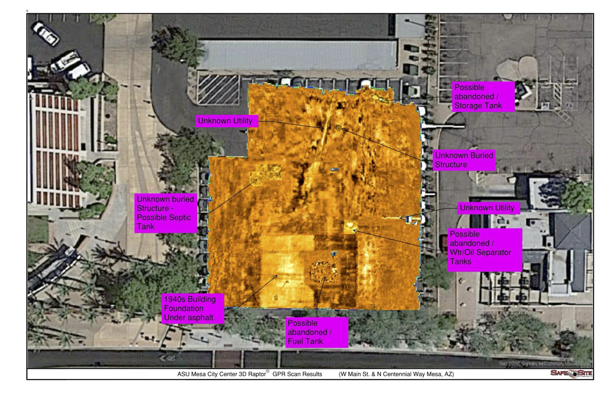
- Underground Storage Tanks & Voids
- Buried Features & Structures (e.g. Manholes, Vaults, Valves)
- Utilities with broken or damaged tracer wire
Ground Penetrating Radar allows our team to see beneath the surface and create accurate maps of what lies below, reducing risk and preventing costly surprises during construction.

The utility locating & damage prevention experts
Safe Site Utility Services is the leading provider of advanced Ground Penetrating Radar (GPR) solutions.
During the pre-design, design, or construction phases, our cutting-edge GPR technology delivers precise subsurface insights.
Projects of any size can benefit from cost-effective 2D radar for smaller areas or comprehensive 3D radar for complete coverage. By combining accuracy, efficiency, and safety, we help clients locate known utilities, investigate abandoned lines, and uncover hidden or unknown underground structures with confidence.
Our Commitment
We are here to help you achieve exceptional results, whether you need to locate known utilities, investigate abandoned ones, or uncover unknown utilities and buried structures.
Our Goal
Our goal on every project is to identify all utility conflicts so there are no surprises during construction.
Contact US
Contact us today and let us know how we can assist you with your project.
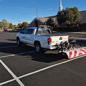
Raptor GPR Radar
At SafeSite LLC, we use the Raptor 3D Ground Penetrating Radar (GPR) system to deliver fast, accurate, and high-resolution subsurface mapping.
What is Raptor GPR?
Raptor GPR is a multichannel, high-speed 3D GPR array designed to collect dense, three-dimensional data beneath the surface at speeds up to 80 mph, with data points recorded every 2 inches.
In addition, it outperforms traditional single-line or low-speed GPR systems. In fact, the high channel count and real-time sampling enable a full 3D view of underground conditions from a single pass.
Traditional GPR vs Raptor GPR
Traditional single-line GPR often requires multiple passes and can produce gaps or errors, but Raptor’s 3D-array delivers clear, intuitive underground images for faster, more reliable interpretation.
Its flexible design adapts to any project, from compact push-cart setups in tight spaces to vehicle-mounted surveys for large corridors, scaling up to 18 channels or more to handle diverse site conditions.

Why Choose GPR Scanning?
Benefits of 2D Ground Penetrating Radar:
2D GPR is ideal for smaller or focused surveys. It provides a linear view of underground utilities, pipes, and voids, helping crews quickly identify anomalies without the need for complex setups. This solution is efficient, reliable, and budget-friendly for projects that do not require full 3D mapping.
Benefits of 3D Ground Penetrating Radar:
3D GPR collects data along multiple parallel lines, creating a complete three-dimensional map of the subsurface. This approach reduces the risk of missing hidden utilities and provides detailed visualizations that are easy to interpret. It also minimizes the number of passes required, saving time while delivering more accurate results.
Benefits of Raptor GPR Radar:
Raptor GPR takes 3D mapping to the next level. It collects high-density data at driving speeds, allowing large areas such as roadways, utility corridors, and construction sites to be scanned quickly. The system produces clear, reliable 3D images, reducing the chance of utility strikes and helping teams plan with confidence. Its flexible design adapts to tight urban spaces or long linear surveys, making it safe, efficient, and cost-effective for large-scale projects.